Since 2010, Hunters Hill Rugby Union Football Club has been converting No. 3 Oval at Boronia Park from a cricket oval into a full-sized rugby field.
- The original drawing for the project showed the field to be 120m x 73m, but recent aerial photographs show the levelled area to be substantially larger (approximately 155m x 80m).
- The work was classified by Council as ‘exempt development‘, meaning that it did not require either Council or the Rugby Club to submit a Development Application. There has been no consultation with the community either before or during this project.
- The Rugby Club has received grant funding towards the cost of the project.
- Most of the work on No. 3 Oval is being managed by the Rugby Club; Council’s contribution consists of removing trees from the southeastern corner at the start of the project, and planting trees, shrubs and groundcover to stabilise the edges after the earthworks are complete.
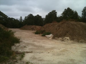
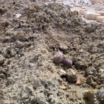
- Most of the fill for the project is said to be ‘clean fill’ from the widening of the M2 motorway, but some still evident contains fragments of broken brick and concrete, ceramic pipe and steel.
- Long heaps of finer material (some contaminated with fragments of building material) currently stockpiled on the southern part of the site are due to be spread over the fill to provide a base for turf (planned to be laid late in the 2013 summer).
- Council has now requested the Rugby Club provide an independent surveyors’ report to allow the current level of fill deposited to be compared with that proposed (and specified in the drawings supplied at the start of the project).
- Council has requested the Rugby Club provide an engineer’s certification as to the adequacy of the two levels of stone retaining walls.
- The field will be fitted with a watering system and a drainage system (neither of which is described in the current drawing). Mains water will be used to irrigate the field (the existing bore which feeds the tank below No. 1 Oval isn’t adequate to supply water even to Nos 1 and 2 Ovals).
- The Club plans to install a fence, 1.1m high, along the eastern side (presumably to help prevent balls from continuing over the edge into the bush below).
- In the future the Club is planning to build a ‘Community Facility’ between Nos 2 and 3 Ovals, the site designated in the Plan of Management for a Community Centre/Hall. Costed at $2.0 million the proposal is to include ‘toilets, canteen, etc. and lights for the oval incorporating storm water and water tanks and would be available for other community groups.’
- Parking for those using No. 3 Oval will be located between Nos 2 and 3 Ovals (reached via the lower part of Princes St which extends through the Park). Access will also be possible via a footpath running from the lower end of Boronia Ave, around the southern end of the field, along the western edge of the field (above the small cliff).
- The work will not be completed until November 2013.
- Council has stated that after the work on No. 3 Oval is completed, the Rugby Club will relinquish use of No. 1 Oval, making it available to other users.
Chronology of changes to No. 3 Oval, Boronia Park
2009 Hunters Hill Rugby Union Football Club received a grant of $35,576 from the NSW government’s Community Building Partnership Grants scheme (App. No. 1757) for a ‘Boronia Park community facility’. A community facility is envisaged in the current Plan of Management for Boronia Park Reserve.
24-8-2010, Barry Smith wrote: ‘The Rugby Club have received a grant to level and re-surface No. 3 oval and this will involve changing levels and batters but not extend.’
29-10-2010 Trucks, under Council supervision, were adding fill to that already dumped along the northeast edge of No. 3 Oval
Dec 2010 Council Meeting gave approval-in-principle for a 20 year lease for the Rugby Club to build a “community facility” in Boronia Park. No construction has yet been authorised.
May 2011 Trees (including some eucalypts) were cut down (by Council or with Council approval) at the southeastern corner of the No. 3 Oval
26-5-2011 Email from David Innes, in response to request for information about work at No. 3 Oval, reads (in part):
‘… the removal of trees at the southeast corner of Boronia Oval No.3. The tree removal is the first step in works to be carried out on the No.3 Oval.’
‘As Council would be aware, Council and the Rugby Club have worked together for many years for the improvement and evolution of the sporting facilities within Boronia Park. Although the Club’s proposal for a community facility to be located between ovals 2 and 3 is still in its early stages of development, the Club and Council have agreed to carry out work on Oval No.3 to make it closer to a full sized rugby field.’
‘The works will involve the following:
1. Providing a slightly increased level playing area that will allow a senior playing field close to a regular full-sized field.
2. Raising the levels of the field to improve drainage and the playing surface
3. Planting of suitable native/indigenous trees at the northern end of the playing field
4. The protection of native trees along the eastern side of the field by constructing stone retaining walls
5. The provision of improved pedestrian access from the end of Boronia Ave at the south eastern corner of the field
6. Planting of replacement native vegetation and trees along the new batters on the eastern side of the field
‘There is no plan to install lighting, and it should be noted that the plan of management does not allow lighting.’
‘The Club is proposing to make this its main field in the longer term. It should be noted that this will free up Boronia 1 for other users, so it is reasonable to assume that other users of the Boronia complex will benefit from improved facilities.’
27-6-2011 In a response to a question without notice to Council Meeting 4307 by Clr Astridge, Council Engineer David Innes responded as follows (see minutes on Council’s website for full response):
‘The works are largely maintenance works, they do not require a development application and would not normally require, or be, the subject of community consultation, as there are no perceived or potential adverse impacts on neighbours, or users of the Reserve.‘ (my emphasis)
‘… an article in Councils Newsletter informing residents of the works and POM may be prudent. Further, a notification of the works will be distributed to residents.’ [Neither of these eventuated]
13-9-2011 Major work started on levelling, building a low stone retaining wall, and extending No. 3 Oval using some hundred truckloads of clean, sandstone fill (said to be from the widening of the M2).
23-11-2011 A drawing of proposed work viewed at Council shows a level area of 120m x 73m, with the level increased by up to 0.4m. In this drawing a single retaining wall is shown at the eastern edge, incorporating a subsoil drain. The quantity of fill required for this can be calculated as 120 x 73 x 0.4 = 3500 cubic meters, plus that required to extend at the south- and north-eastern corners giving a total of, say, 5000 cubic meters. Allowing 30 cubic meters for a truck/trailer load, this is equivalent to approximately 170 truck/trailer movements.
26-4-2012 Aerial photography shows that the level area has been extended approximately 30% longer than that shown in the drawing (155m x 75-85m).
May 2012 Work ceased
July 2012 Work restarted, building a second, higher retaining wall above the first wall. Much stone delivered to site, but not all used.
Sept 2012 Work ceased, but small loads of dirty (i.e. contaminated) fill accumulated on-site
Dec 2012 Work restarted, removing and/or burying dirty waste, and moving surplus stone to the area adjacent to No. 3 Oval.
12-12-2012 Meeting between Rugby Club meeting and Council (minutes attached).


My family resides in Bonnefin Road and has a clear view of the south eastern corner where more than 25 trees were removed without TPO approval. We observed some of these to be gum trees. It is distressing to see Council management’s complete disregard of the Boronia Park Reserve – Plan of Management. The PoM does not permit modifying the area’s topography yet we have seen the level of oval No.3 raised by a few metres. What the hell is going on? Is Council management completely unanswerable?